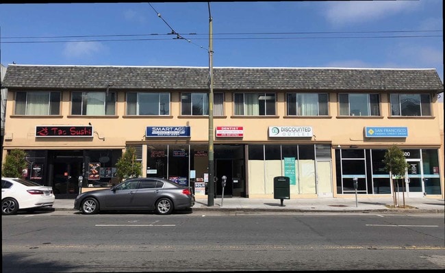
Property Record
4800 Mission St, San Francisco, CA 94112


Current Lease Availabilities
NEARBY LISTINGS FOR SALE OR LEASE
Property Detail
4800 Mission St
San Francisco
West End Map #1
San Francisco-Redwood City-South San Francisco, CA
BLK 12 LOT 9
6959-028
San Francisco
Storemultistory
California
2024
28
2025
0.18 AC
026100
Southern City
14,228 SF
DEMOGRAPHICS near 4800 Mission St
1 Mile
3 Mile
5 Mile
2024 Total Population
53,406
347,418
818,691
2029 Population
47,853
319,185
759,256
Pop Growth 2024-2029
(10.40%)
(8.13%)
(7.26%)
Average Age
44
43
42
2024 Total Households
15,773
120,239
320,329
HH Growth 2024-2029
(10.90%)
(8.48%)
(7.66%)
Median Household Inc
$114,897
$125,957
$119,646
Avg Household Size
3.20
2.70
2.40
2024 Avg HH Vehicles
2.00
2.00
1.00
Median Home Value
$1,071,872
$1,083,607
$1,084,036
Median Year Built
1948
1949
1952
Nearby Places
Map Layers
Map Styles
 Street
 Aerial
- Restaurants
- Banks
- Shops
- Fitness
- Groceries
PUBLIC TRANSPORTATION
TRANSIT/SUBWAY
Balboa Park Station (J Church - San Francisco Municipal Railway (MUNI Metro), K Ingleside - San Francisco Municipal Railway (MUNI Metro))
DRIVE
WALK
Distance
Balboa Park Station (J Church - San Francisco Municipal Railway (MUNI Metro), K Ingleside - San Francisco Municipal Railway (MUNI Metro))
2 min
10 min
0.6 mi
Balboa Park Station (Dublin/Pleasanton - Millbrae - Bay Area Rapid Transit (BART), Fremont - Daly City - Bay Area Rapid Transit (BART), Pittsburg/Bay Point - San Francisco International - Bay Area Rapid Transit (BART), Richmond - Millbrae - Bay Area Rapid Transit (BART))
DRIVE
WALK
Distance
Balboa Park Station (Dublin/Pleasanton - Millbrae - Bay Area Rapid Transit (BART), Fremont - Daly City - Bay Area Rapid Transit (BART), Pittsburg/Bay Point - San Francisco International - Bay Area Rapid Transit (BART), Richmond - Millbrae - Bay Area Rapid Transit (BART))
2 min
13 min
0.7 mi
San Jose Ave & Santa Ynez Ave (J Church - San Francisco Municipal Railway (MUNI Metro))
DRIVE
WALK
Distance
San Jose Ave & Santa Ynez Ave (J Church - San Francisco Municipal Railway (MUNI Metro))
7 min
15 min
0.8 mi
COMMUTER RAIL
Bayshore (Caltrain - Caltrain (Caltrain))
DRIVE
WALK
Distance
Bayshore (Caltrain - Caltrain (Caltrain))
6 min
2.1 mi
22nd Street (Caltrain - Caltrain (Caltrain))
DRIVE
WALK
Distance
22nd Street (Caltrain - Caltrain (Caltrain))
12 min
2.9 mi
AIRPORT
San Francisco International
DRIVE
WALK
Distance
San Francisco International
14 min
11.3 mi
Metro Oakland International
DRIVE
WALK
Distance
Metro Oakland International
32 min
23.8 mi
Freight Ports
Port of San Francisco
DRIVE
WALK
Distance
Port of San Francisco
1 min
5.7 mi
Nearby Properties
Address
Land Use
TOTAL SIZE
Lot Size
Zoning
Address
Land Use
TOTAL SIZE
Lot Size
Zoning
248,303 SF
4.35 AC
Address
Land Use
TOTAL SIZE
Lot Size
Zoning
411,904 SF
21.74 AC
C2
Address
Land Use
TOTAL SIZE
Lot Size
Zoning
346,710 SF
7.45 AC
RH2
Address
Land Use
TOTAL SIZE
Lot Size
Zoning
312,191 SF
2.74 AC
Address
Land Use
TOTAL SIZE
Lot Size
Zoning
54,000 SF
1.67 AC
PDR2
Address
Land Use
TOTAL SIZE
Lot Size
Zoning
42.95 AC
Address
Land Use
TOTAL SIZE
Lot Size
Zoning
447,674 SF
21.51 AC
Address
Land Use
TOTAL SIZE
Lot Size
Zoning
439,294 SF
5.43 AC
PDR2
Address
Land Use
TOTAL SIZE
Lot Size
Zoning
143,920 SF
7.29 AC
PDR2
Address
Land Use
TOTAL SIZE
Lot Size
Zoning
183,284 SF
6.85 AC
PD0000
Address
Land Use
TOTAL SIZE
Lot Size
Zoning
2.03 AC
C2
Address
Land Use
TOTAL SIZE
Lot Size
Zoning
28,300 SF
4.94 AC
M2
Address
Land Use
TOTAL SIZE
Lot Size
Zoning
88,900 SF
5.37 AC
NCS
Address
Land Use
TOTAL SIZE
Lot Size
Zoning
80,000 SF
0.48 AC
RM1
Address
Land Use
TOTAL SIZE
Lot Size
Zoning
160,983 SF
1.84 AC
NC2
Address
Land Use
TOTAL SIZE
Lot Size
Zoning
13,200 SF
3.54 AC
PDR2
Address
Land Use
TOTAL SIZE
Lot Size
Zoning
1.33 AC
M1
Address
Land Use
TOTAL SIZE
Lot Size
Zoning
31,400 SF
2.76 AC
PDR2
Address
Land Use
TOTAL SIZE
Lot Size
Zoning
279,560 SF
13.24 AC
M10000
Address
Land Use
TOTAL SIZE
Lot Size
Zoning
160,000 SF
1.27 AC
C2
Address
Land Use
TOTAL SIZE
Lot Size
Zoning
Address
Land Use
TOTAL SIZE
Lot Size
Zoning
95,469 SF
3.68 AC
RH-1
Address
Land Use
TOTAL SIZE
Lot Size
Zoning
73,491 SF
4.48 AC
C2
Address
Land Use
TOTAL SIZE
Lot Size
Zoning
12,555 SF
0.74 AC
NCS
Address
Land Use
TOTAL SIZE
Lot Size
Zoning
176,000 SF
1.64 AC
C2
Address
Land Use
TOTAL SIZE
Lot Size
Zoning
3.77 AC
Address
Land Use
TOTAL SIZE
Lot Size
Zoning
54,131 SF
1.75 AC
C2
Address
Land Use
TOTAL SIZE
Lot Size
Zoning
6.87 AC
RH2
Address
Land Use
TOTAL SIZE
Lot Size
Zoning
107,362 SF
5.74 AC
M1
Address
Land Use
TOTAL SIZE
Lot Size
Zoning
181,172 SF
2.11 AC
The World's #1 Commercial Real Estate Marketplace
Connect with us
© 2025 CoStar Group
The information above has been obtained from sources believed reliable. While we do not doubt its accuracy we have not verified it and make no guarantee, warranty or representation about it. It is your responsibility to independently confirm its accuracy and completeness. Any projections, opinions, assumptions, or estimates used are for example only and do not represent the current or future performance of the property. The value of this transaction to you depends on tax and other factors which should be evaluated by your tax, financial, and legal advisors. You and your advisors should conduct a careful, independent investigation of the property to determine to your satisfaction the suitability of the property for your needs.